
Geography of Andalucía
To us, one of the huge attractions of Andalucía is the variety of the countryside, from the windswept sandy beaches of Cádiz to the rocky peaks of the Sierra Nevada. The diverse landscape is matched by extremes of climate: the Sierra de Grazalema in the province of Cádiz is one of the wettest places in Spain, whereas Cabo de Gata in Almería is the driest. The vegetation varies with the climate, being much lusher in the west, where the rains come in off the Atlantic, than in the arid east.
Sierra Morena
To the north, Andalucía is bounded by the rolling Sierra Morena mountains, which stretch 400 km east from the Portuguese border, through the provinces of Huelva, Seville, Córdoba and Jaén. Historically, the Sierra Morena formed a natural barrier between Andalucía and the rest of Spain, and there are still relatively few main roads through the mountains.
Guadalquivir valley and Atlantic coast
Below the Sierra Morena, the Guadalquivir river valley forms a large, elongated triangle, stretching from the source of the river in the Sierra de Cazorla in the northeast down to the Atlantic in the southwest. This is the agricultural heartland of Andalucía, with the olive groves of the upper valley gradually giving way to wheat, oranges, vines and – finally, and controversially – strawberries as you head downstream.

The wetlands around the river’s estuary, which are an important stopover for migrating birds, are protected as the Doñana National Park. Either side of the estuary, you have the wide, sandy beaches of the Andalucía’s Atlantic coastline, known as Costa de la Luz. Their one downside is that they can be windy, but for windsurfers and kitesurfers that’s just an added attraction.

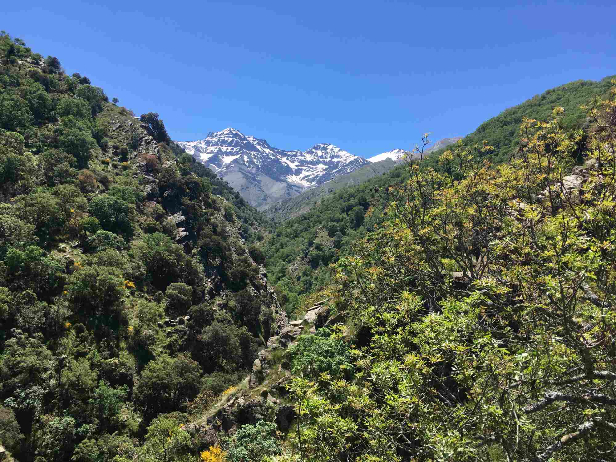
Sierra Nevada
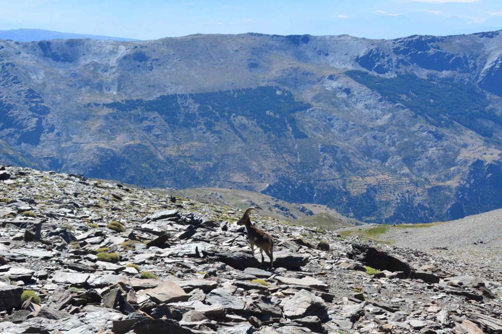
South of the Guadalquivir, a series of mountain ranges separate the river valley from the Mediterranean coast. The highest of these is the Sierra Nevada, where you find Mulhacén, at 3,479 metres above sea level the tallest mountain in the Iberian Peninsula. Once upon a time, the peaks of these mountains were snow-covered all year round, but climate change has put paid to that.
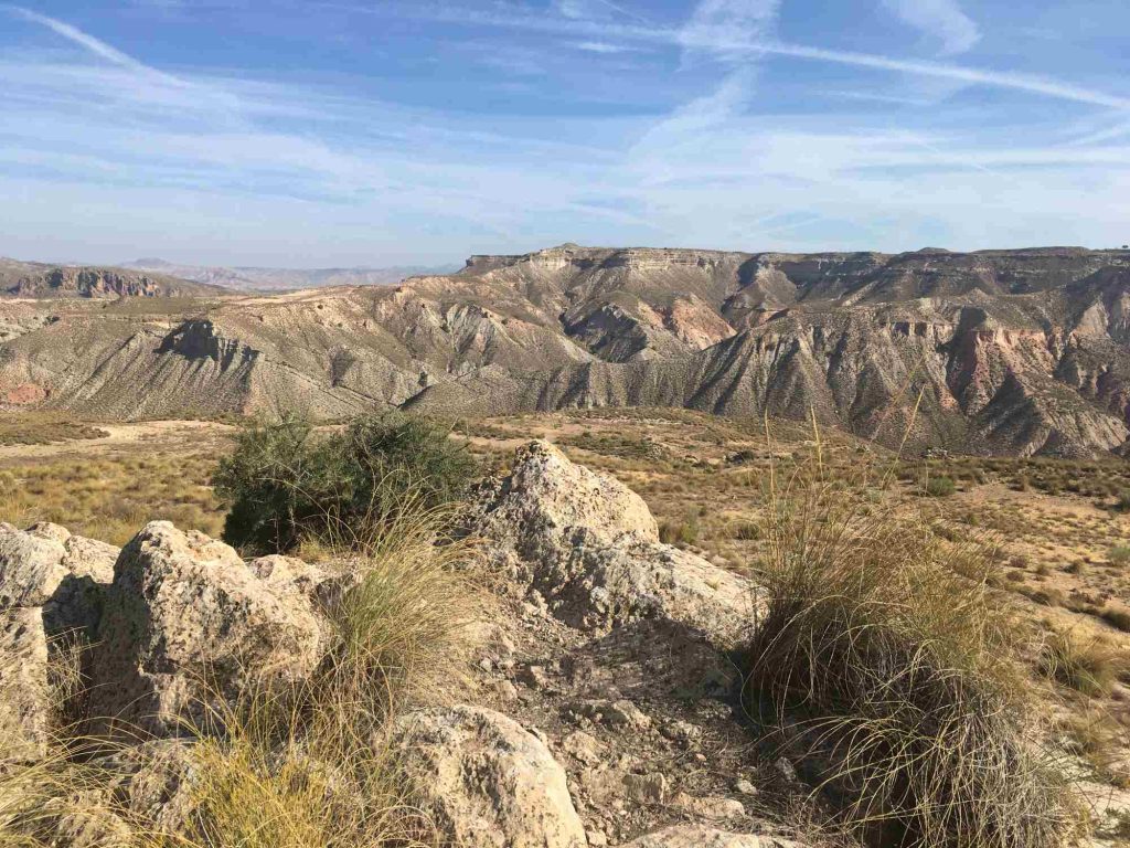
Moving east from the Sierra Nevada, the climate gets drier. In the north of Granada province you have the Granada Geopark, which is one of the areas within the European continent least altered by humans. The most striking features are the dry and hostile badlands, occasionally punctuated by surprisingly lush river valleys. Even further east and south, you reach the arid mountains of Almería, as well as the Tabernas desert, said to be the only true desert in Europe.
Mediterranean coast
Right along the Mediterranean coastline, there is a relatively narrow coastal strip backed by scenic mountains. Traditionally, the people here have lived from fishing, agriculture and commerce, but these days tourism dominates. The mild winters allow tropical and subtropical fruits to be cultivated, including mango and avocado. In Almería, fruit and vegetables are produced on an industrial scale in greenhouses.
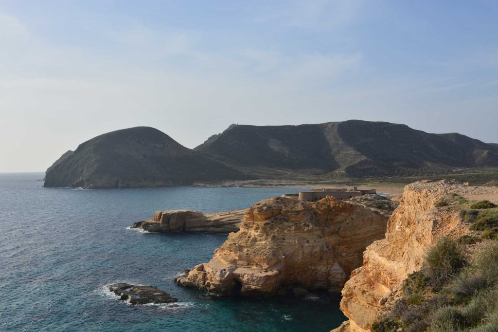
The most famous part of the coastline is the Costa del Sol, with its sandy beaches in the provinces of Málaga and Cádiz. Next, heading east, you reach the Costa Tropical in Granada province, which has fine gravel beaches. The final stretch is the Costa de Almería, which includes the lovely coves and sandy beaches of Cabo de Gata, a Marine-Terrestrial Natural Park with an incredibly dry climate that suits cactuses and other succulents.
Related articles
Related itineraries

City and Mountains: Granada and Alpujarra
4-5 Nights

Guadalquivir River Valley
8 nights +
Questions and answers
The Sierra de Grazalema in the province of Cádiz is the wettest place in Andalucía, and one of the wettest in the whole of Spain.
The driest place in Spain is Cabo de Gata on the coast of Almería in the south-east corner of the country.
The Iberian Peninsula is the peninsula in south-west Europe occupied by Spain and Portugal. It is separated from the rest of Europe by the Pyrenees.
Mulhacén is the highest mountain in the Iberian Peninsula at 3,479 metres above sea level. However, it is not the highest mountain in Spain – Teide in the Canary Islands is over 200 m higher.
Andalucía’s Atlantic coastline, known as the Costa de la Luz has wide, sandy beaches. They are often windswept with big waves, so it’s a great destination for windsurfing and kitesurfing. The most famous part of the Mediterranean coastline is the Costa del Sol, with its sandy beaches in the provinces of Málaga and Cádiz. The Costa Tropical in Granada province has fine gravel beaches. The Costa de Almería in the south-east corner of Spain includes the lovely coves and sandy beaches of Cabo de Gata, a Marine-Terrestrial Natural Park.